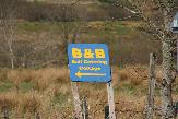
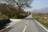
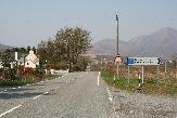
DirectionsBest to print directions off before you leave as phone coverage on Skye is very patchy.DO NOT just use GPS to find us as it would mislead you! You follow the main road A87 coming from the bridge towards Broadford. After approx. six miles you will come into upper Breakish and you will see a Restaurant called Red Skye on the left hand side. You keep going until you see the Breakish hall on your right side (small green building) and then a bus shelter on your left side (the road from lower Breakish comes onto the main road here from the right). If you see the bus shelter you start indicating to your left since the road is going downhill (there is an artificial horse figure on the right side) and our entrance is JUST on the left where you go down. There is also a sign saying: Priority over oncoming traffic (white and red arrow) on the right and our entrance is to your left, before(!) the big Elm tree. There is a small sign in front of the tree saying: Struanlea. You turn in left an then right into our garden where you see a white post box with a red flag. DO NOT TURN OFF THE MAIN ROAD before. Our house is facing the main road, so the only turning off to your left is after the bus shelter. The cottage is in the back of the garden. Maybe this Google maps link can also help: https://goo.gl/maps/TFKC4Zb7K9LFUqaS6 ///What3WordsHere is a precise what3words address, made of 3 random words. Every 3 metre square in the world has its own unique what3words address.
GPS InstructionsDo not use our post code as you end up in Lower Breakish. Postcodes in the Highlands do not work well. If you are coming from the East you can use the postcode IV42 8QB and watch out for our house 250m before you have reached your destination. If your GPS can use coordinates you can also use:
| 
|
||||||||||||||||||
|
|||||||||||||
The Cottage at Struanlea |
 |